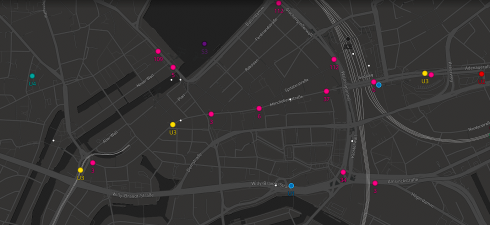
The operator of Hamburg Public Transport repeatedly got blamed for the lack of a central real-time information system. A Hamburg-based software developer and a UX designer have taken action on this gap.
Oct 22, 2017In general, public transport in Hamburg is on time. However, on rare occasions, we might experience delays and cancellations due to bad weather conditions, increased traffic, or various types of construction work. In such situations, the operator of public transport in Hamburg (“HVV”) repeatedly gets blamed for the lack of a central real-time information system. And that’s where some guys at Ubilabs enter the scene:
Ubilabs is a Hamburg-based software company – specialized in interactive maps… Ubilabs software developer Franz Neubert (@scarysize) and UX designer Mirko Hamann took action on this gap. They designed a clean map of the Hamburg transport network providing the most relevant information on all buses, subways, trains, and ferries operated by the HVV: every single HVV vehicle is displayed as a point that moves along its route in real time.
Clicking on the vehicle highlights its entire route and reveals detailed information on the next stops and any delays when applicable. Considering the most obvious use case, the interactive map works more than smoothly on a smartphone.
At peak times there are up to 1,200 points on the map.
Ubilabs developer Franz Neubert
As the HVV does not provide standardized access to their real-time data, they had to find other sources to retrieve the required data. If you are into software development, Franz Neubert provides you with some technical insights on the development process in his article on Medium.
The HVV Real-time Map: https://hvv.live/